Wolfram Function Repository
Instant-use add-on functions for the Wolfram Language
Function Repository Resource:
Generate a 3D mesh region for geographic locations with accurate elevation data
ResourceFunction["GeoElevationRegion"][loc] returns a 3D mesh region representing loc with accurate elevation data. |
| "BaseElevation" | Automatic | base elevation |
| GeoModel | Automatic | model of the Earth (or other body) to use |
| GeoZoomLevel | Automatic | level of resolution of the elevation array |
| "ProjectedRegion" | True | projected region |
| "RegionType" | Automatic | region type |
| "ScaleFactor" | Automatic | scale factor to use for vertical exaggeration |
"RegionType" can take any of the following values:
| Automatic | automatically determine the region type |
| "BoundaryMeshRegion" | create a boundary mesh region |
| "FullBoundaryMeshRegion" | create a full boundary mesh region |
| "FullMeshRegion" | create a full mesh region |
| "MeshRegion" | create a mesh region |
| "Earth" | max zoom 12 |
| "Mars" | max zoom 7 |
| "Mercury" | max zoom 6 |
| "Moon" | max zoom 8 |
| "Pluto" | max zoom 5 |
Create a mesh region for Mount Everest:
| In[1]:= |
| Out[1]= | 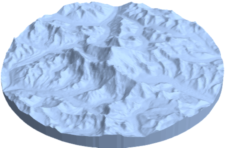 |
Create a mesh region for a set of disks around a set of positions:
| In[2]:= |
| Out[2]= |  |
Create a mesh region for Hawaii:
| In[3]:= |
| Out[3]= | 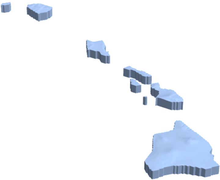 |
Create a mesh region for the United States:
| In[4]:= |
| Out[4]= | 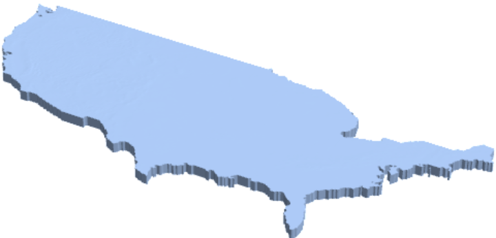 |
Create a mesh for Hawaii,clipped at the polygon edge:
| In[5]:= |
| In[6]:= |
| Out[6]= | 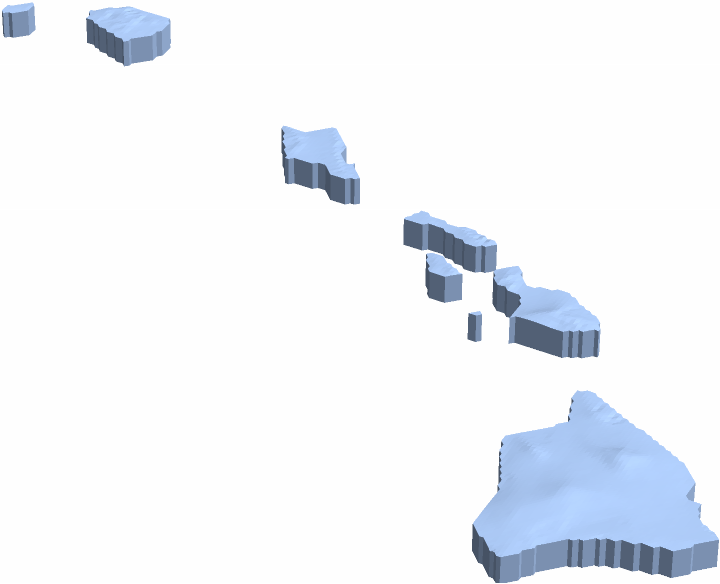 |
Create a mesh for Hawaii, but extend the data out to 200 miles, including bathymetry data:
| In[7]:= |
| Out[7]= | 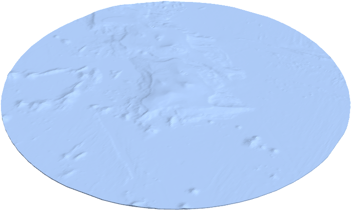 |
Elevations below sea level can be removed using ProjectedRegion and BaseElevation:
| In[8]:= |
| Out[8]= | 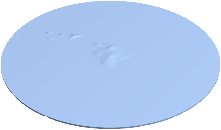 |
"BaseElevation" can be used together with "ProjectedRegion"→False to ignore elevations below a specified threshold:
| In[9]:= | ![Show[ResourceFunction["GeoElevationRegion"][
Entity["Mountain", "MountSaintHelens"], "ProjectedRegion" -> False, "BaseElevation" -> Quantity[0, "Feet"]], ViewPoint -> {2.16, 3.4, -0.11}, ViewVertical -> {0.1, 0.14, 1}]](https://www.wolframcloud.com/obj/resourcesystem/images/5bf/5bf412c4-c622-4f2c-a071-f69770e81e63/6e15c7b93eeb33dc.png) |
| Out[9]= | 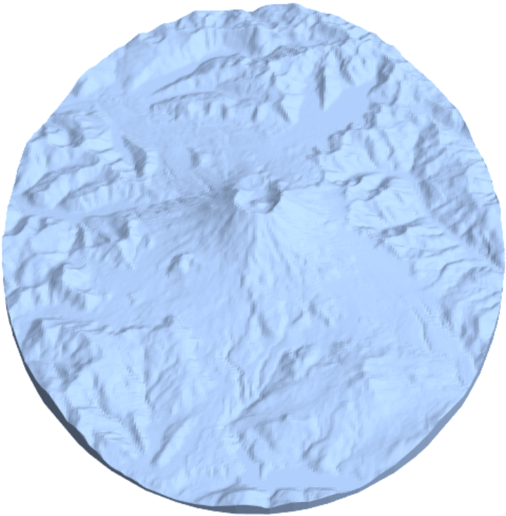 |
| In[10]:= | ![Show[ResourceFunction["GeoElevationRegion"][
Entity["Mountain", "MountSaintHelens"], "ProjectedRegion" -> False, "BaseElevation" -> Quantity[4000, "Feet"]], ViewPoint -> {2.16, 3.4, -0.11}, ViewVertical -> {0.1, 0.14, 1}]](https://www.wolframcloud.com/obj/resourcesystem/images/5bf/5bf412c4-c622-4f2c-a071-f69770e81e63/2d0eec848ad7956d.png) |
| Out[10]= | 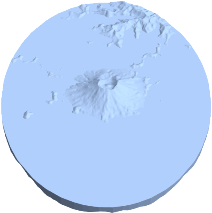 |
Specify regions for other geomodels:
| In[11]:= |
| Out[11]= | 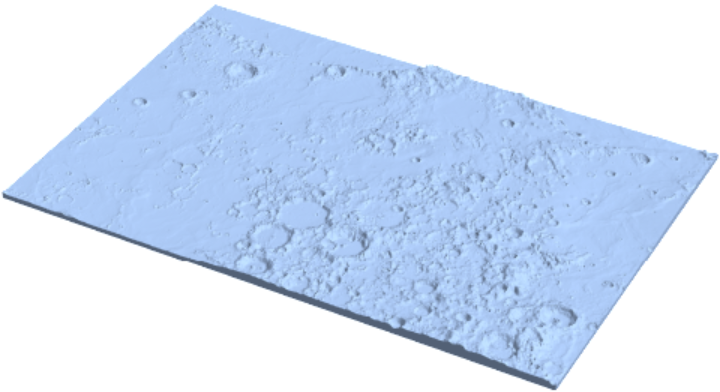 |
Generate meshes with different resolutions:
| In[12]:= |
| Out[12]= | 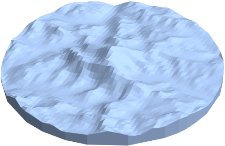 |
| In[13]:= |
| Out[13]= | 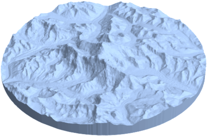 |
| In[14]:= |
| Out[14]= | 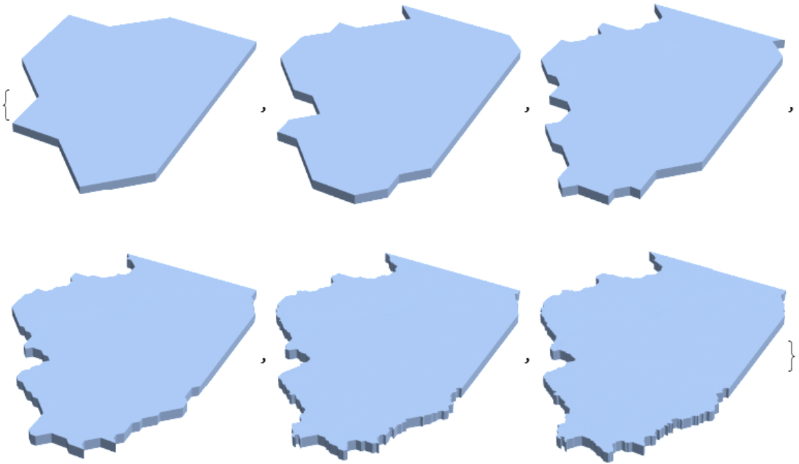 |
By default, regions are projected onto a flat surface:
| In[15]:= | ![Show[ResourceFunction["GeoElevationRegion"][
Entity["Country", "UnitedStates"]], ViewPoint -> {-0.13, -2.82, 1.86}, ViewVertical -> {0, -0.03, 1}]](https://www.wolframcloud.com/obj/resourcesystem/images/5bf/5bf412c4-c622-4f2c-a071-f69770e81e63/4184d38281e43b40.png) |
| Out[15]= | 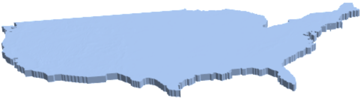 |
To maintain a spherical surface, "ProjectedRegion" can be set to False:
| In[16]:= | ![Show[ResourceFunction["GeoElevationRegion"][
Entity["Country", "UnitedStates"], "ProjectedRegion" -> False], ViewPoint -> {0.02, 3.0, -1.47}, ViewVertical -> {0.02, 0.87, 0.49}]](https://www.wolframcloud.com/obj/resourcesystem/images/5bf/5bf412c4-c622-4f2c-a071-f69770e81e63/41ca360f4d5b167c.png) |
| Out[16]= | 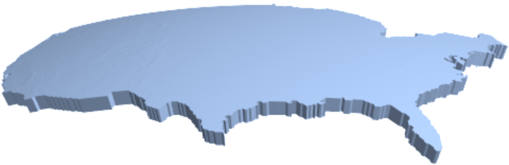 |
Different types of regions can be constructed:
| In[17]:= |
| Out[17]= | 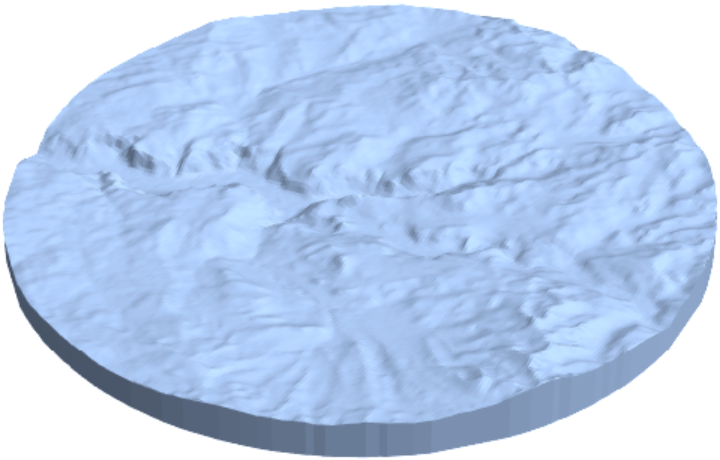 |
| In[18]:= |
| Out[18]= |
| In[19]:= | ![bmr = ResourceFunction["GeoElevationRegion"][
GeoDisk[Entity["SolarSystemFeature", "OlympusMonsMars"], Quantity[400, "Miles"]], "ScaleFactor" -> 5]](https://www.wolframcloud.com/obj/resourcesystem/images/5bf/5bf412c4-c622-4f2c-a071-f69770e81e63/4e75942f6a73439c.png) |
| Out[19]= | 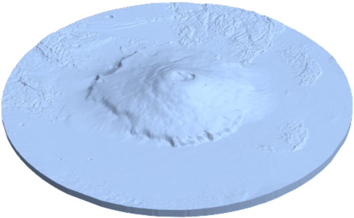 |
| In[20]:= |
| Out[20]= |
Specify vertical exaggeration:
| In[21]:= |
| Out[21]= | 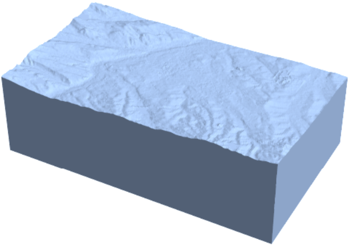 |
| In[22]:= |
| Out[22]= | 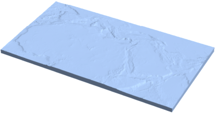 |
| In[23]:= | ![ResourceFunction["GeoElevationRegion"][
GeoPolygon[{GeoPosition[{10, -50.6}], GeoPosition[{70, 0.2}], GeoPosition[{20, 30}], GeoPosition[{-30, 0}]}], "ScaleFactor" -> 10]](https://www.wolframcloud.com/obj/resourcesystem/images/5bf/5bf412c4-c622-4f2c-a071-f69770e81e63/7fbf67fa27868105.png) |
| Out[23]= |  |
| In[24]:= |
| Out[24]= |  |
GeoElevationRegion is similar to GeoElevationGraphics3D, but there are differences.
| In[25]:= |
| Out[25]= | 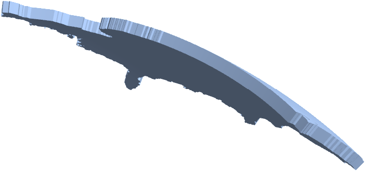 |
| In[26]:= |
| Out[26]= | 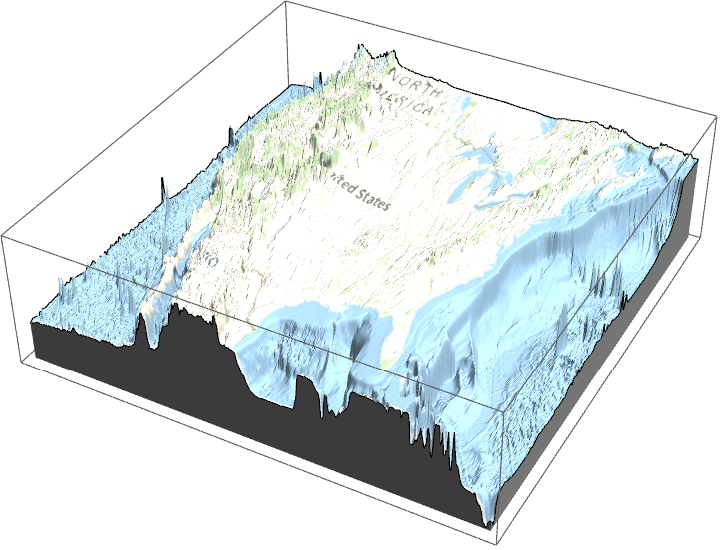 |
| In[27]:= |
| Out[27]= |
| In[28]:= |
| Out[28]= |
In addition, GeoElevationGraphics3D always generates elevations from a flat surface, but GeoElevationRegion allows the data to be with respect to a spherical Earth
The number of polygons for the entire world is large for the smallest GeoZoomLevel:
| In[29]:= | ![AbsoluteTiming[
MeshCellCount[
ResourceFunction["GeoElevationRegion"][
GeoBoundsRegion[{{-90, 90}, {-180, 180}}], GeoZoomLevel -> 1]]]](https://www.wolframcloud.com/obj/resourcesystem/images/5bf/5bf412c4-c622-4f2c-a071-f69770e81e63/607129c3b10abacd.png) |
| Out[29]= |
| In[30]:= |
| In[31]:= |
| In[32]:= | ![Show[ResourceFunction["GeoElevationRegion"][
Entity["AdministrativeDivision", {"Campania", "Italy"}], "ProjectedRegion" -> False, "BaseElevation" -> 0, "ScaleFactor" -> 1, GeoZoomLevel -> 7], ViewPoint -> reorient 2 solfatara["XYZ"]]](https://www.wolframcloud.com/obj/resourcesystem/images/5bf/5bf412c4-c622-4f2c-a071-f69770e81e63/0d4d421b7a8ca592.png) |
| Out[32]= | 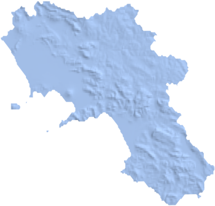 |
Wolfram Language 14.0 (January 2024) or above
This work is licensed under a Creative Commons Attribution 4.0 International License