Wolfram Function Repository
Instant-use add-on functions for the Wolfram Language
Function Repository Resource:
Show an animation of the full history of a historical country's territory, along with borders of any modern country it intersected during a given year
ResourceFunction["HistoricalCountryAnimate"][entity] produces an animation of the history of entity, displaying its geographic territory over time. |
View the historical geographic development of the Byzantine Empire:
| In[1]:= |
| Out[1]= | 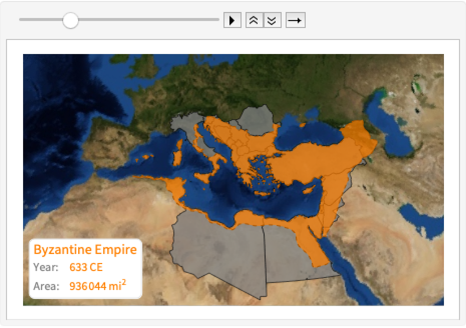 |
View the history of the Roman Republic, excluding modern country borders:
| In[2]:= | ![ResourceFunction["HistoricalCountryAnimate"][
Entity["HistoricalCountry", "RomanRepublic"], "CurrentCountries" -> False]](https://www.wolframcloud.com/obj/resourcesystem/images/055/0550634e-8677-4c0e-ba85-62ef495456e2/299bf36b3f0eb596.png) |
| Out[2]= | 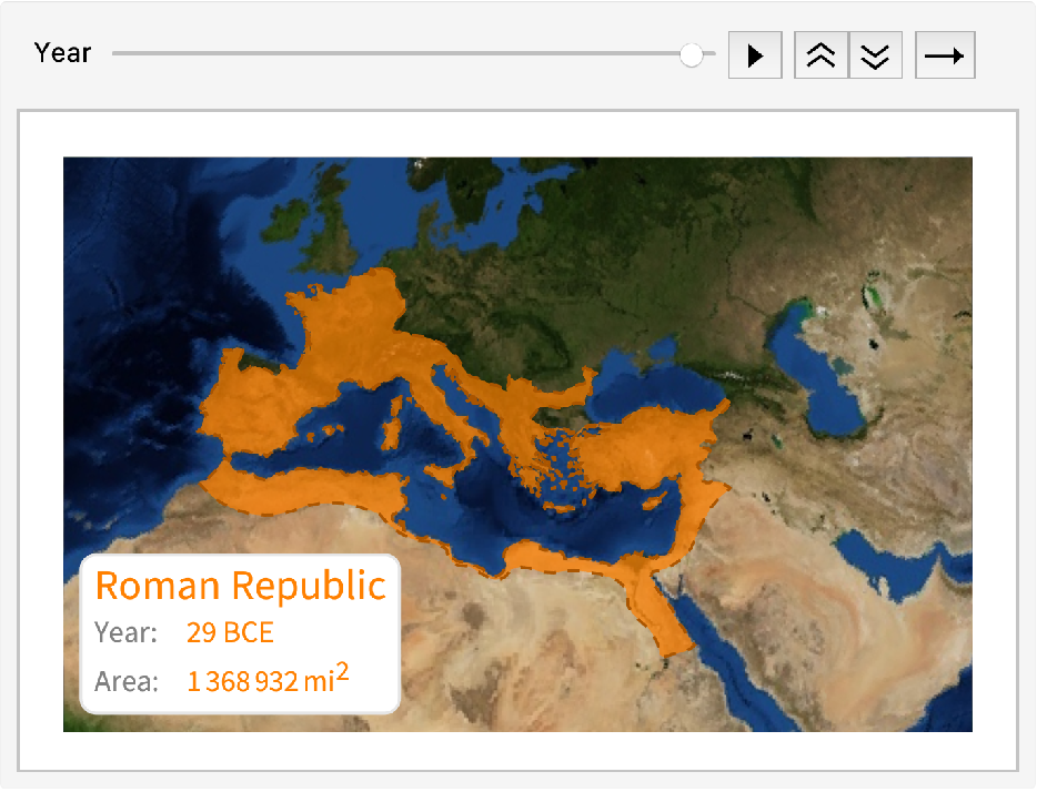 |
View the historical Ottoman Empire without tooltips:
| In[3]:= |
| Out[3]= | 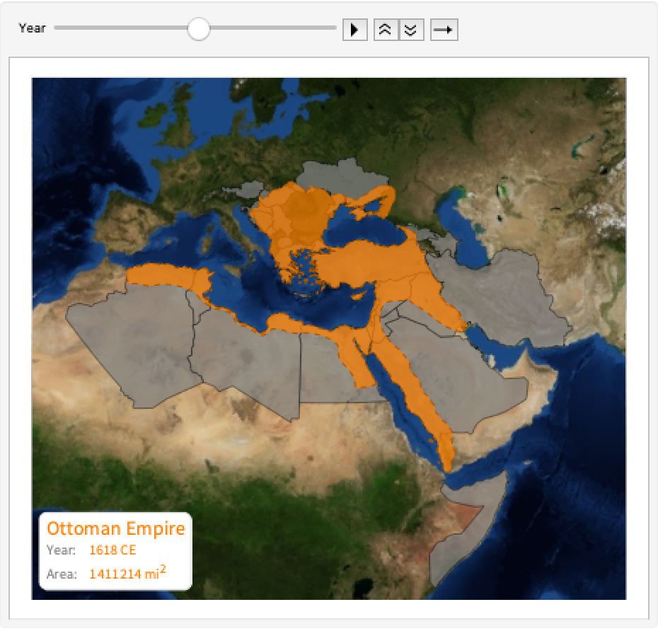 |
If "CurrentCountries" is set to False, the "Tooltips" setting will be ignored:
| In[4]:= | ![ResourceFunction["HistoricalCountryAnimate"][
Entity["HistoricalCountry", "OttomanEmpire"], "CurrentCountries" -> False, "Tooltips" -> True]](https://www.wolframcloud.com/obj/resourcesystem/images/055/0550634e-8677-4c0e-ba85-62ef495456e2/6597106d4ae51976.png) |
| Out[4]= | 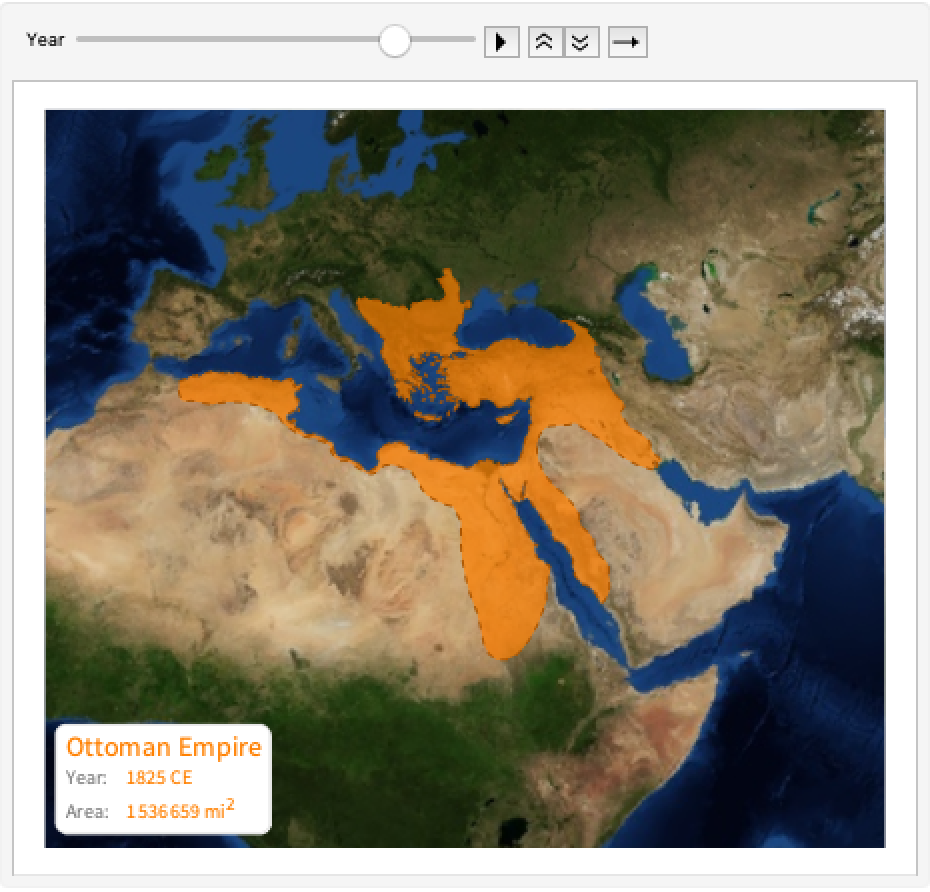 |
View the progression of the Mongol Empire over a relief map to show terrain:
| In[5]:= | ![ResourceFunction["HistoricalCountryAnimate"][
Entity["HistoricalCountry", "MongolEmpire"], "CurrentCountries" -> False, GeoBackground -> "ReliefMap"]](https://www.wolframcloud.com/obj/resourcesystem/images/055/0550634e-8677-4c0e-ba85-62ef495456e2/02681d9fa660a6c0.png) |
| Out[5]= | 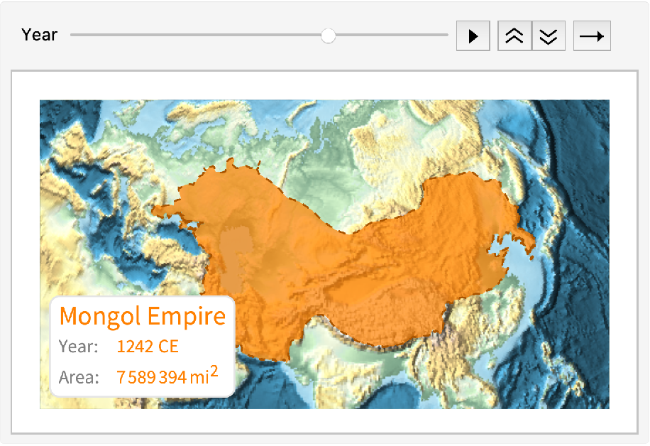 |
Rasterize the frames (and remove tooltips) for a smoother-running animation:
| In[7]:= |
| Out[7]= | 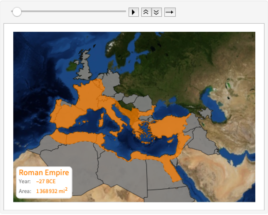 |
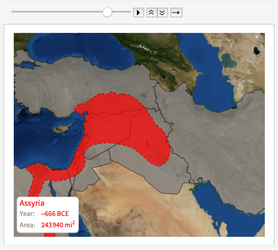
HistoricalCountryAnimate will only work for "HistoricalCountry" entities that include at least one polygon in the system. Any other input will result in an unevaluated expression:
| In[8]:= |
| Out[8]= |
This work is licensed under a Creative Commons Attribution 4.0 International License