Details and Options
pos can be an entity with a suitable position property, in which case
ResourceFunction["OpenWebMap"][pos] is equivalent to
ResourceFunction["OpenWebMap"][GeoPosition[pos]].
pos can be a pair {lat,lon} of geographic coordinates.
ResourceFunction["OpenWebMap"][pos,"URL"] returns a
URL object.
ResourceFunction["OpenWebMap"][pos] is equivalent to
SystemOpen[ResourceFunction["OpenWebMap"][pos]] If pos contains more than one coordinate, the mean of the coordinates is taken.
The following options are supported by ResourceFunction["OpenWebMap"]:
The following settings are supported for the
GeoServer option:
| Automatic | equivalent to "Google" |
| "Bing" | Microsoft Bing Maps » |
| "Google" | Google Maps » |
| "GoogleEarth" | Google Earth for web » |
| "HERE" | HERE WeGo » |
| "OpenStreetMap" | OpenStreetMap » |
A
StringTemplate or other template object may also be supplied to the
GeoServer option, in which case the template is called with zoom, decimal latitude, and decimal longitude provided as the first, second, and third slots respectively.
If a template object is supplied to the
GeoServer option, any setting for the
GeoBackground option is ignored.
The following settings are supported for the
GeoBackground option:
| Automatic | the default map type |
| "Satellite" | satellite imagery |
| "StreetMap" | street map data |
| "Terrain" | basic street map data with shaded topography and elevation |
Some mapping services do not support both map types.
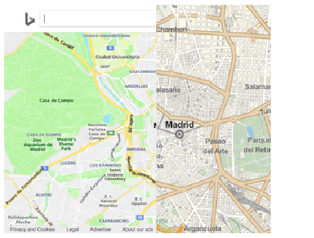
![ResourceFunction["ImageSplitCompare"][
WebImage[
First@ResourceFunction["OpenWebMap"][position, "URL", GeoServer -> "Bing", GeoZoomLevel -> 13]],
GeoImage[position, "StreetMap", GeoZoomLevel -> 13],
Automatic, "Fit"
]](https://www.wolframcloud.com/obj/resourcesystem/images/bae/baeb499d-762b-4d65-afcb-3dbede1c2336/186fd64409b0d27a.png)
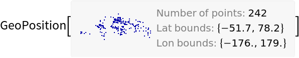
![position = GeoPosition[
DeleteMissing@
EntityValue[
EntityClass["Country", "Countries"][
EntityProperty["Country", "CapitalCity"]], "Position"]]](https://www.wolframcloud.com/obj/resourcesystem/images/bae/baeb499d-762b-4d65-afcb-3dbede1c2336/22131adae539a8c3.png)
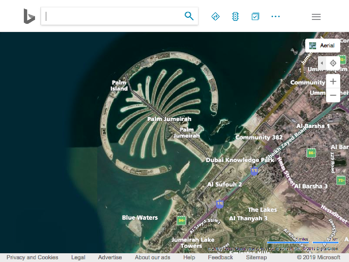
![WebImage[First@
ResourceFunction["OpenWebMap"][
Entity["Island", "PalmJumeirah::r87sm"], "URL", GeoServer -> "Bing", GeoBackground -> "Satellite", GeoZoomLevel -> 13]]](https://www.wolframcloud.com/obj/resourcesystem/images/bae/baeb499d-762b-4d65-afcb-3dbede1c2336/2dfaf4e874cb8649.png)