Wolfram Function Repository
Instant-use add-on functions for the Wolfram Language
Function Repository Resource:
Import OSM (OpenStreetMap) data from XML files or the OSM API
ResourceFunction["OSMImport"][path] imports the OSM XML file at path. | |
ResourceFunction["OSMImport"][GeoBoundsRegion[…]] imports OSM data within the specified region. | |
ResourceFunction["OSMImport"][entity] imports OSM data within the bounding box of entity entity. |
Import OSM data from a region:
| In[1]:= |
Visualize the ways:
| In[2]:= |
| Out[2]= | 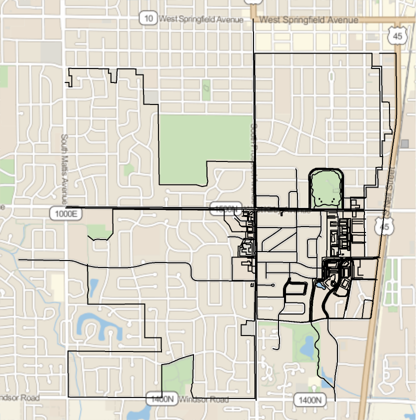 |
Use the "Tags" field to select only rivers:
| In[3]:= |
| In[4]:= |
| Out[4]= |
| In[5]:= | ![GeoGraphics[
Values[Line[Values[osm[["Nodes", #Nodes, "Position"]]]] & /@ Select[osm["Ways"], #[["Tags", "waterway"]] === "river" &]]]](https://www.wolframcloud.com/obj/resourcesystem/images/413/41349457-7935-4638-811c-fcc67bacc7f7/632061bfc707f056.png) |
| Out[5]= | 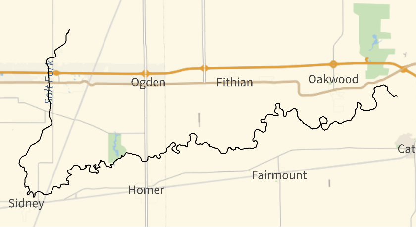 |
Select only power lines:
| In[6]:= | ![GeoGraphics[
Values[Line[Values[osm[["Nodes", #Nodes, "Position"]]]] & /@ Select[osm["Ways"], #[["Tags", "power"]] === "line" &]]]](https://www.wolframcloud.com/obj/resourcesystem/images/413/41349457-7935-4638-811c-fcc67bacc7f7/088cb852db69616c.png) |
| Out[6]= | 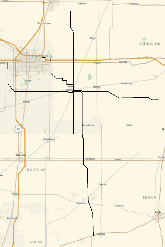 |
Select only railways:
| In[7]:= | ![GeoGraphics[
Values[Line[Values[osm[["Nodes", #Nodes, "Position"]]]] & /@ Select[osm["Ways"], KeyExistsQ[#Tags, "railway"] &]]]](https://www.wolframcloud.com/obj/resourcesystem/images/413/41349457-7935-4638-811c-fcc67bacc7f7/3b050b32591675e4.png) |
| Out[7]= | 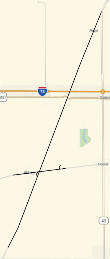 |
Wolfram Language 11.3 (March 2018) or above
This work is licensed under a Creative Commons Attribution 4.0 International License