Wolfram Function Repository
Instant-use add-on functions for the Wolfram Language
Function Repository Resource:
Set the elevation of one or multiple geodetic positions
ResourceFunction["ElevateGeoPosition"][pos,value] return geodetic position pos with its elevation set to value. | |
ResourceFunction["ElevateGeoPosition"][pos,f] apply f to each elevation value in pos. | |
ResourceFunction["ElevateGeoPosition"][{pos1,pos2,…},…] adjust the elevation of each of the posi. | |
ResourceFunction["ElevateGeoPosition"][value] represents an operator form of ResourceFunction["ElevateGeoPosition"] that can be applied to an expression. |
A point 100 meters above the reference ellipsoid at the current geo location:
| In[1]:= |
| Out[1]= |
Set the elevation of each member of a geo position array:
| In[2]:= |
| Out[2]= | 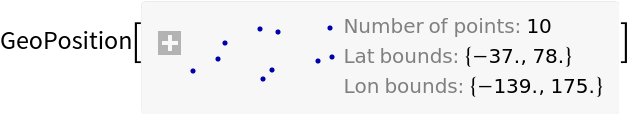 |
| In[3]:= |
| Out[3]= |
Get a GeoPosition representing the summit of Olympus Mons:
| In[4]:= | ![ResourceFunction["ElevateGeoPosition"][
Entity["SolarSystemFeature", "OlympusMonsMars"], Entity["SolarSystemFeature", "OlympusMonsMars"]["Elevation"]]](https://www.wolframcloud.com/obj/resourcesystem/images/331/331c2948-8bfb-4c25-89a9-ae9f6d847a99/45b16752ea8bbbed.png) |
| Out[4]= |
GeoPosition objects of arbitrary dimensions are supported:
| In[5]:= | ![{
ResourceFunction["ElevateGeoPosition"][RandomGeoPosition[{2, 2}], 100],
ResourceFunction["ElevateGeoPosition"][RandomGeoPosition[{2, 2, 2}], 100],
ResourceFunction["ElevateGeoPosition"][
RandomGeoPosition[{2, 2, 2, 2}], 100]
}](https://www.wolframcloud.com/obj/resourcesystem/images/331/331c2948-8bfb-4c25-89a9-ae9f6d847a99/0e98fed3eaa49f40.png) |
| Out[5]= | 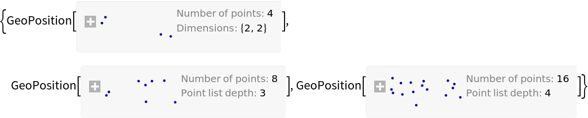 |
| In[6]:= |
| Out[6]= |
GeoGridPosition objects are supported:
| In[7]:= |
| Out[7]= |
Add 100km to the current elevations of each of the GPS satellites by supplying a transformation function:
| In[8]:= | ![gpsPositions = EntityValue[EntityClass["Satellite", "GPS"], "Position"];
ListPlot[{
#["Elevation"] & /@ gpsPositions,
#["Elevation"] & /@ ResourceFunction["ElevateGeoPosition"][
gpsPositions, # + Quantity[100, "Kilometers"] &]
}]](https://www.wolframcloud.com/obj/resourcesystem/images/331/331c2948-8bfb-4c25-89a9-ae9f6d847a99/238b285c0ad10011.png) |
| Out[9]= | 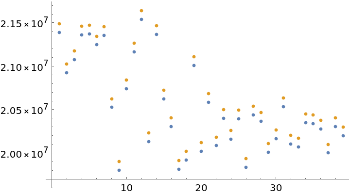 |
An operator form of ElevateGeoPosition is available:
| In[10]:= |
| Out[10]= |
GeoPositionXYZ and GeoPositionENU objects are not supported, as they do not directly encode geodetic elevation:
| In[11]:= | ![xyz = GeoPositionXYZ[{148217.79, -4.88253*^6, 4.0877119*^6}];
enu = GeoPositionENU[{2344, 138231, 0}, GeoPosition[{45, 0}]];
ResourceFunction["ElevateGeoPosition"][{xyz, enu}, 40] // Column](https://www.wolframcloud.com/obj/resourcesystem/images/331/331c2948-8bfb-4c25-89a9-ae9f6d847a99/0b6522cc281f6a94.png) |
| Out[12]= | 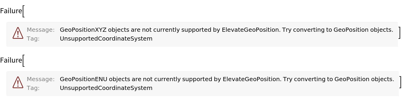 |
These positions can be used by converting them to GeoPosition objects before applying ElevateGeoPosition, and back to their original coordinate systems after:
| In[13]:= |
| Out[13]= |
| In[14]:= |
| Out[14]= |
This work is licensed under a Creative Commons Attribution 4.0 International License