Wolfram Function Repository
Instant-use add-on functions for the Wolfram Language
Function Repository Resource:
Look up recent crimes recorded by the UK police
ResourceFunction["UKCrimeData"][loc] finds crimes reported in the previous month within 1 mile of GeoLocation loc. | |
ResourceFunction["UKCrimeData"][{p1,p2,…] finds crimes reported in the previous month within the polygon bounded by pi. | |
ResourceFunction["UKCrimeData"][loc,type] finds crimes of a specific type. | |
ResourceFunction["UKCrimeData"][loc,type,date] finds crimes of a specific type recorded in the month containing date. |
| GeoRange | Automatic | range to search around the geo location. Ignored if a polygon is specified. Automatic searches a 1 mile radius |
| "CrimeType" | "All crime" | type of crime to search for |
Find crimes recorded in the previous month in Oxford:
| In[1]:= |
| Out[1]= | 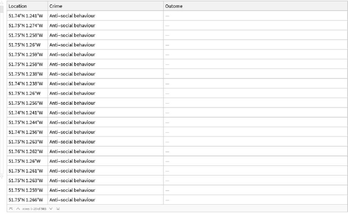 |
Show their locations:
| In[2]:= |
| Out[2]= | 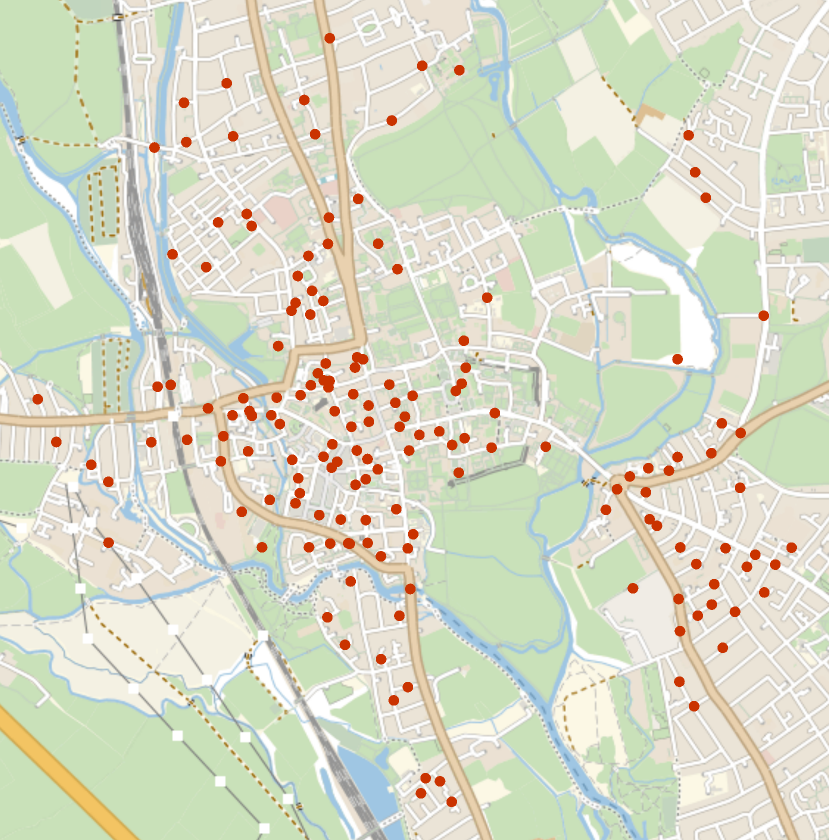 |
View the distribution of types:
| In[3]:= |
| Out[3]= | 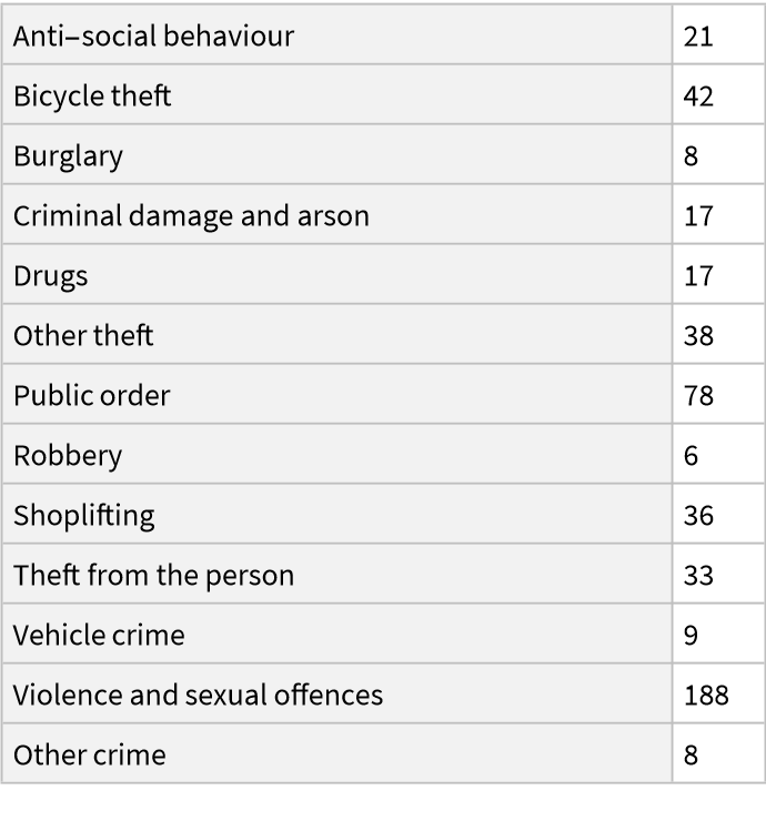 |
View only the recorded incidences of Shoplifting:
| In[4]:= |
| Out[4]= | 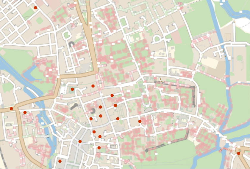 |
View crimes in the month of August 2021:
| In[5]:= |
| Out[5]= | 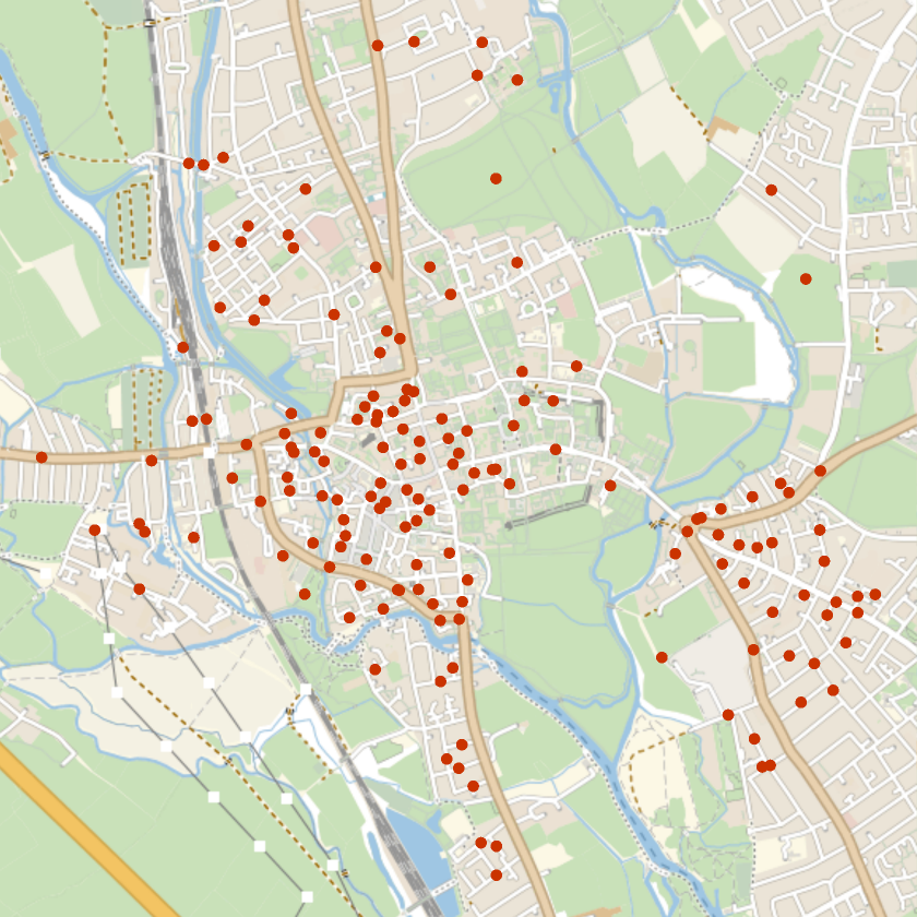 |
Locations can be given using GeoPosition:
| In[6]:= |
| Out[6]= |
Or using an entity:
| In[7]:= |
| Out[7]= |
Or a UK Postcode:
| In[8]:= |
| Out[8]= |
Or with a polygon of GeoPosition values:
| In[9]:= | ![ResourceFunction["UKCrimeData"][{
GeoPosition[{51.75, -1.25}],
GeoPosition[{51.5, -1.25}],
GeoPosition[{51.5, -1.3}],
GeoPosition[{51.75, -1.3}]
}, "CrimeType" -> "Bicycle theft"] // Length](https://www.wolframcloud.com/obj/resourcesystem/images/918/91844883-efb5-46e2-904b-1f09c79ffcd0/67a8cdf50e04eff7.png) |
| Out[9]= |
When using a single GeoLocation crimes within 1 mile are found:
| In[10]:= |
| Out[10]= | 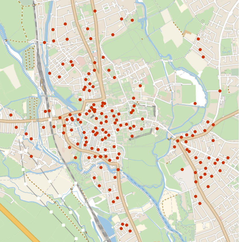 |
You can control this range with GeoRange:
| In[11]:= |
| Out[11]= | 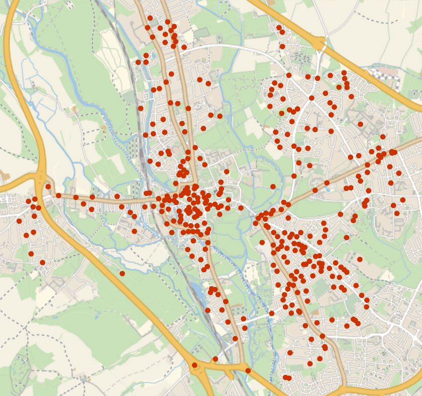 |
You can limit the types of crime to be returned with "CrimeType":
| In[12]:= | ![ResourceFunction["UKCrimeData"][
Entity["City", {"Oxford", "Oxfordshire", "UnitedKingdom"}], GeoRange -> Quantity[2, "Miles"], "CrimeType" -> "Bicycle theft"][GeoListPlot, "Location"]](https://www.wolframcloud.com/obj/resourcesystem/images/918/91844883-efb5-46e2-904b-1f09c79ffcd0/4b2af8754394c97d.png) |
| Out[12]= | 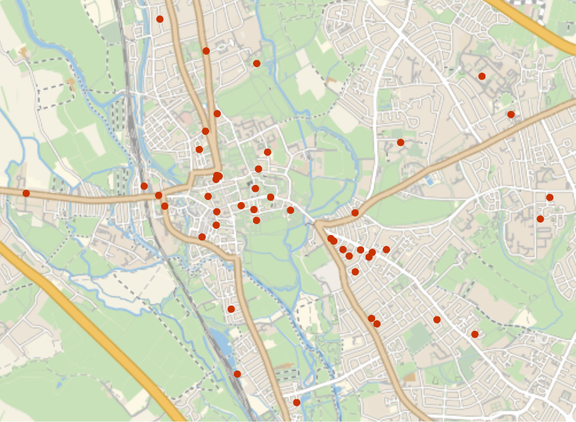 |
The UK Police API will not return more than 10,000 crimes in a single request:
| In[13]:= |
| Out[13]= |
This work is licensed under a Creative Commons Attribution 4.0 International License