Radio Horizon Distance
The horizon or skyline is the apparent line that separates earth from sky, the line that divides all visible directions into two categories: those that intersect the Earth's surface, and those that do not. The radio horizon distance assumes a generally line-of-sight propagation, which means that the waves travel in a direct path from the source to the receiver.
The radio horizon distance increases with altitude.
Formula
![QuantityVariable["d", "Distance"] == Quantity[1, "NominalEarthEquatorialRadius"]*(1 + Quantity[4/3, "NominalEarthEquatorialRadius"^(-1)]*QuantityVariable["h", "Height"])*Sqrt[1 - (1 + Quantity[4/3, "NominalEarthEquatorialRadius"^(-1)]*QuantityVariable["h", "Height"])^(-2)]](https://www.wolframcloud.com/objects/resourcesystem/marketplacestorage/resources/e89/e890a635-7c08-49cb-8a9e-40adf4904a1e/Webpage/FormulaImage.png "Copy to Clipboard")
Forms
Examples
Get the resource:
| In[1]:= |
| Out[1]= |  |
Get the formula:
| In[2]:= |
| Out[2]= |  |
Use some values:
| In[3]:= |
| Out[3]= | 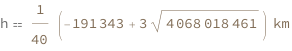 |