Pix2pix Street-Map-to-Photo Translation
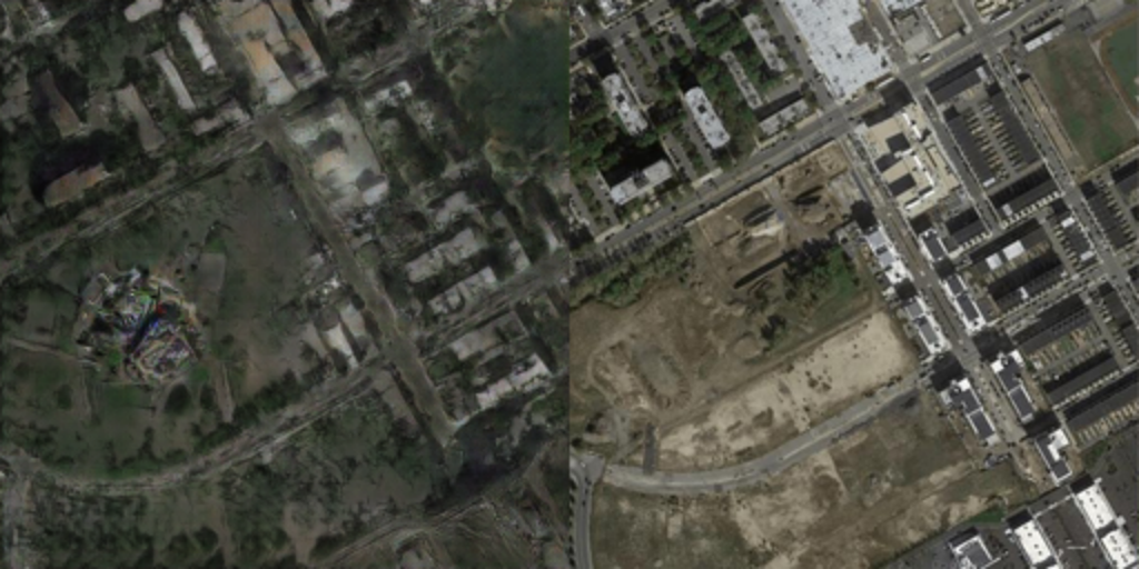
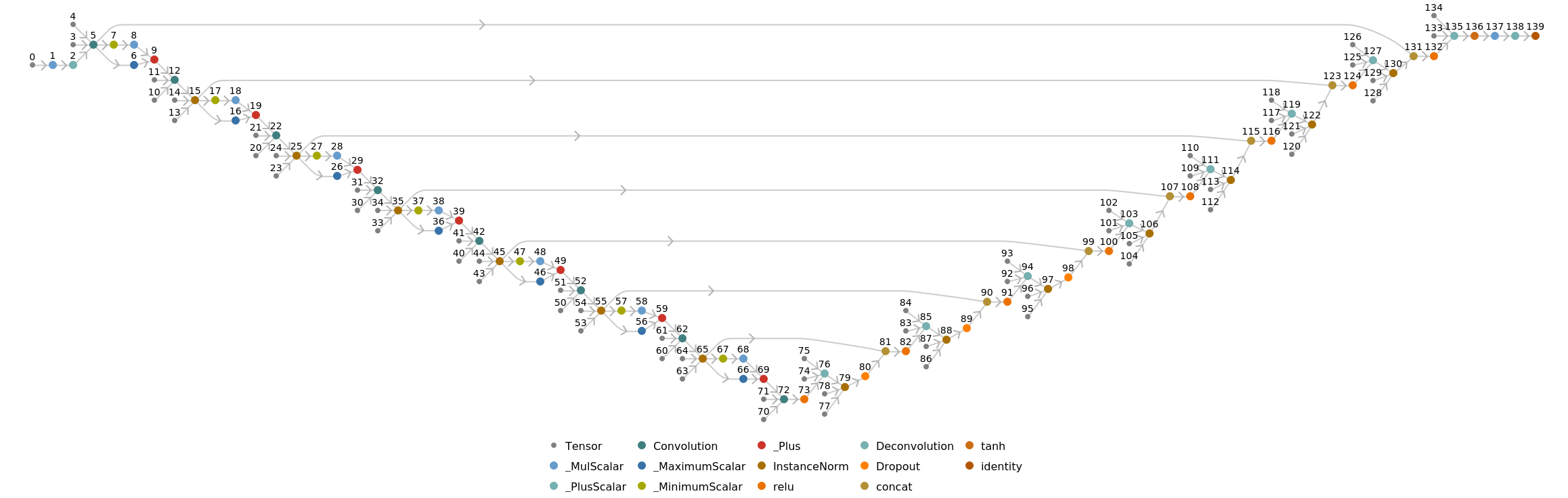
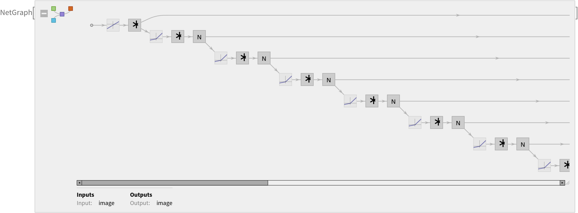
Released in 2016, this model is an application of a powerful method for general-purpose image-to-image translation using conditional adversarial networks. The automatic learning of the loss function with the adversarial networks technique allows the same paradigm to generalize across a wide range of image translation tasks. The architecture enables an efficient aggregation of features of multiple scales through skip connections with concatenations. This particular model was trained to generate a street map from a satellite photo.
Number of layers: 56 |
Parameter count: 54,419,459 |
Trained size: 218 MB |
Examples
Resource retrieval
Get the pre-trained net:
Basic usage
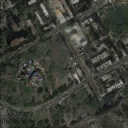
Start with a street map:
Draw a satellite photo from a street map:
Evaluate accuracy
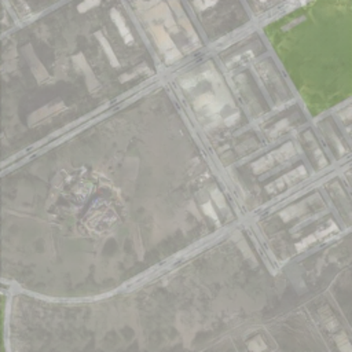
Overlap map and prediction:
Compare the generated satellite photo with the actual satellite photo:
Net information
Inspect the number of parameters of all arrays in the net:
Obtain the total number of parameters:
Obtain the layer type counts:
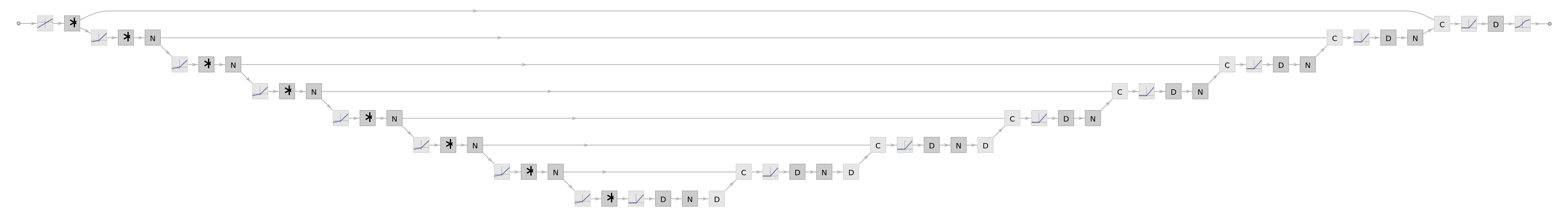
Display the summary graphic:
Export to MXNet
Export the net into a format that can be opened in MXNet:
Export also creates a net.params file containing parameters:
Get the size of the parameter file:
The size is similar to the byte count of the resource object:
Represent the MXNet net as a graph:
Requirements
Wolfram Language
11.2
(September 2017)
or above
Resource History
Reference
![(* Evaluate this cell to get the example input *) CloudGet["https://www.wolframcloud.com/obj/d3c98920-5ed4-4aa3-ab0d-31984a34e913"]](https://www.wolframcloud.com/obj/resourcesystem/images/e38/e3859dc9-a7a2-47d2-99bf-355663dda194/71bec02a7ec3737c.png)
![(* Evaluate this cell to get the example input *) CloudGet["https://www.wolframcloud.com/obj/a676262c-04cb-4021-9fe7-f02045c18046"]](https://www.wolframcloud.com/obj/resourcesystem/images/e38/e3859dc9-a7a2-47d2-99bf-355663dda194/0ac50a56505dbb4e.png)